A wonderfully powerful, 360°-integrated instrument encased in an ultra-sharp 12" full HD touch screen: among in-vehicle instrumentation, you’ve never seen a display like this. GPSMAP® 8412 is equipped with a high-performance processor to process cartography with unprecedented speed and allows you to customize screens, data and indicators. Everything is designed to allow the user to quickly access, with a single gesture, all the information needed in the most stressful situations, such as sleeping.
Create your own integrated system
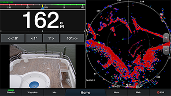
Connecting the GPSMAP® 8412 to the Garmin Marine Network allows you to view data processed by on-board instrumentation such as radar, autopilots, sounder modules, multimedia devices (FUSION-Link), thermal imaging cameras, GRID and more on the display. GPSMAP® 8412 also allows information to be shared with other compatible GPSMAP units, such as maps and user data, including waypoints, routes and tracks. This means that user data entered can be automatically synchronized with other chartplotters on the network.
Limitless connectivity
The new GPSMAP® 8412 chartplotter integrates seamlessly with a multiplicity of on-board instruments thanks to its built-in Wi-Fi® and ANT+ connectivity, 4 Ethernet ports, NMEA 2000 network, HDMI port, USB port and many more. It’s also compatible with FLIR cameras. Built-in Wi-Fi technology allows you to use the free ActiveCaptain® app to access OneChartâ"¢, Smart Notification1, community data Garmin Quickdrawâ " ¢ and more. You can also control streaming video playback from the GCâ " ¢ 100 wireless camera and VIRB® action cams. In addition, built-in ANT wireless technology allows you to directly connect your quatix® watch, gWindâ"¢ Wireless 2 transducer and wireless remotes.
Digital Switching
Completely new interface for managing MasterBus and Czone on-board networks. You'll be able to turn on engines, activate pumps, turn on underwater lights, and keep tabs on lights right from the chartplotter screen, all with intuitive, easy-to-use graphics.
The best of Garmin and the best of Navionics®
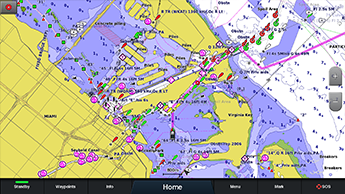
The new GPSMAP® 8412 display is compatible with the latest Garmin BlueChart® g3 and BlueChart® g3 Vision cartography, which integrates BlueChart data with Navionics data to deliver the best cartography ever. This new cartography also includes Auto Guidance technology, which allows you to avoid hazards and obstacles by working out safe routes to set destinations based on craft 2 features.
Take control from the comfort of your seat
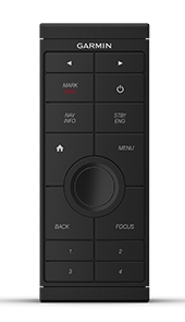
It’s no longer necessary to stand at the helm for hours. The optional intuitive GRIDâ"¢ 20 remote control provides remote access and maximum control over the entire onboard Garmin system. It includes a 360-degree rotating joystick, rotary knob and push-to-select button for simplified navigation and precise control of menus and chartplotter settings, even in rough seas.
Race functions
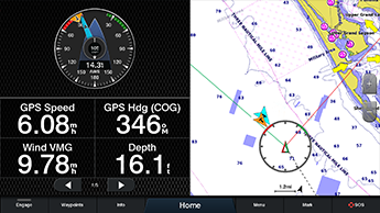
The new GPSMAP® 8412 chartplotter has a useful feature dedicated to those who sail or compete in regattas. Thanks to SailAssistâ"¢ you can see on the screen the right time to tack or gybe, simultaneously display the apparent and true wind angle, keep an eye on tides and currents, display heading and course line at the same time, activate the Pre-race guidance function to cut the start line at the right time and with maximum speed and keep an eye on the wind thanks to intuitive graphs.
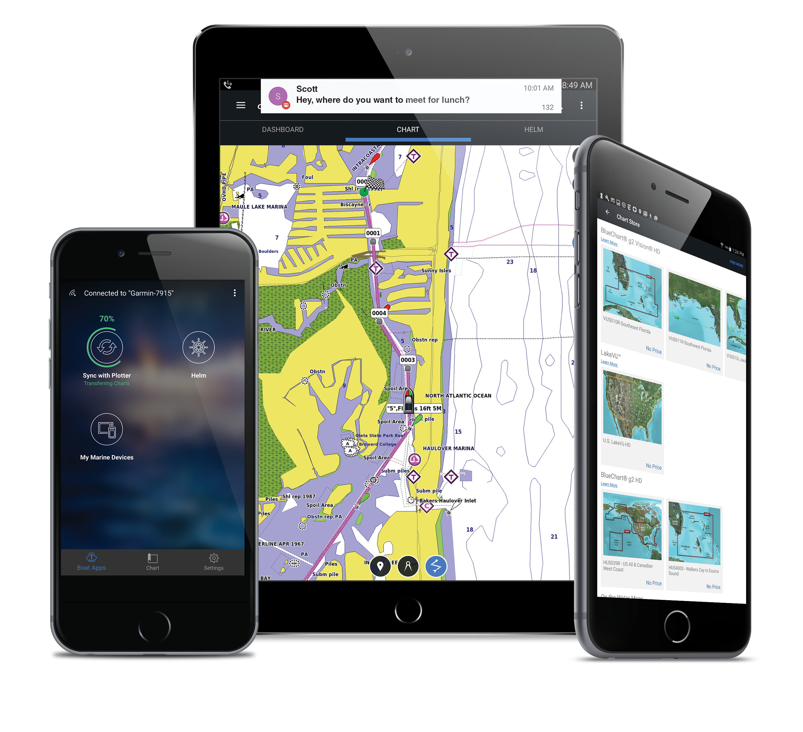
Make your boat smart
Use the new ActiveCaptainâ"¢ app to connect your Garmin Marine chartplotter to the mobile network and make your boat smart. ActiveCaptainâ"¢ is free and will allow you to make the most of your onboard instrumentation.
1Whenpaired with a compatible smartphone,
2AutoGuidance should be used for planning purposes and is not a substitute for safe navigation operations


